Google Maps update brings sharper satellite imagery
Google Maps satellite imagery has received a major boost in quality. Thanks to the new Landsat 8 satellite, the images are now sharper with better color.
Landsat 8 was launched into orbit in 2013 by USGS and NASA to replace Landsat 7. The satellite imagery we had before was from Landsat 7, which served us well over the years but the image quality wasn't good enough anymore and a hardware failure caused it to produce large diagonal lines across images.
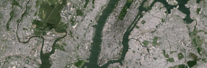 Before
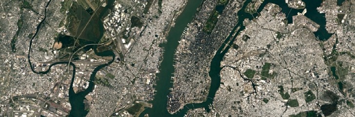 After
After
Landsat 8, in comparison, captures images with greater detail, truer color and over twice the frequency of Landsat 7. Google then had to sift through millions of images to combine the cloud free ones and create the mosaic that you see on your screen. The result is visible through Google Maps on every device once you switch to the satellite view and Google Earth.
The Landsat data is free and available to everyone through Google's Earth Engine.
Related


Reader comments
- Mohammed Mahmood
- 29 Jun 2016
- f}D
Google always strive for robust technology, thanks to Google
- MAHIMA
- 29 Jun 2016
- uw6
good google good
- AnonD-402029
- 29 Jun 2016
- IWb
i wonder how long they need to map the entire earth


 Samsung
 Apple
Apple Apple
Apple Xiaomi
 Apple
Apple